New semi-automated survivability count method
Posted 17 October 2023
Species, sites and planting Managing trees Economic benefits and markets
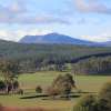
PFT trial Esk Spatial's new semi-automated survivability count method testing technology capabilities against more manual survivability count methods.
Round 1 of the Integrated Farm Forestry Demonstration Sites program is now in its third year.
Seven properties received funding to assist with plantation establishment costs, and to develop landscape scale best practice forestry plantings dispersed throughout the state including a range of species, and a mix of shelterbelts and woodlots totalling 201 hectares.
With seedlings now approaching 2 years of age, PFT sought the opportunity to conduct a test trial using ESK Spatial’s new semi-automated survivability count.
PFT trialled this new method on two properties located near Dunalley in the south, and Evandale in the north to gain an understanding of the capabilities of this new technology and to learn how results compared to survival counts done in the more manual ‘traditional’ method. Findings are yet to be determined with PFT exploring the technology further once seedlings are at a greater height and weed competition is at a minimum.
Esk Spatial have provided the following information to explain their exciting new process.
Introduction
When establishing forests it is critical to ensure that the initial establishment operations achieved the required survival rates and planting stocking rates to fully occupy and maximise the growing potential of the site. This ensures the forest will achieve the goals of the grower, whether they be for environmental or production use. A ‘survival count’ assessment is typically undertaken within the first 6 to 12 months after planting to sign off that the forest has achieved the required standards.
Esk Spatial have developed a semi-automated method for undertaking a 100% survival count by way of capturing and analysing drone imagery, vastly improving on old techniques typically undertaken by foot which were only based on a small sample of seedlings (say 10%) which would not have taken stock of the whole area.
Capturing imagery
Esk Spatial captured high-resolution imagery (3cm resolution) of the trial sites using a drone, allowing us to see individual seedlings/stems clearly and distinguish them from their often ‘noisy’ surroundings.
Detecting Stems
A total of 24,343 stems were detected and pinpointed across the two trial sites. Manually extracting these from the imagery would be highly laborious and expensive, taking more than 70 hours.

Using state of the art neural network based object detection models, Esk Spatial trained up algorithms to detect the 1,000s of stems in a matter of minutes. Esk Spatial has adopted and developed these object detection methods for several years successfully locating 100,000s of seedlings and trees for a range of species, environments and age classes.
Height Calculation
As part of the process a 3D model is also generated. Using the locations of the detected stems, Esk Spatial can use the 3D model to calculate the individual height for each and every stem which is extremely valuable information for tracking the growth rates and health of the trees.

The richness and accuracy of forest information that can now be collected remotely with semi- and fully automated means across 100% of the area by Esk Spatial provides invaluable information to tree growers, and in a manner that is truly cost effective.
For more information please contact Esk Spatial on 1300 375 772 or email enquiries@eskspatial.com.au
Share this Article
Latest Articles
-

17 September 2025
Celebrating excellence at the Tasmanian Timber Awards
-

17 September 2025
Forest Practices Authority Research Update Day
-
13 August 2025
Have you seen our Stems for CO2 Project signage on the Midlands Highway?
Archives
- ActivAcre hits milestone, calls for more farmers to get on board
- Napier's leading the way in sustainable forestry and carbon-neutral farming
- Sound science needed to assess carbon impacts of timber harvesting
- Newly appointed TFFPN Board of Directors
- Graduate Certificate of Forestry Scholarship
- Forestry Australia Mentoring Program 2025
- Forest Industry Roundtable planning for the long term
- Eagle Management Constraint Period extended
- Successful private native forest management celebrated
- $15 million investment in new ship loader to boost Bell Bay's forestry exports
- Standing with Tasmania's forestry industry: buy local
- TFPA: Tasmanian Freight Equalisation Scheme needs a ground-up review
- AFCA Gala Dinner celebrates industry excellence
- Fire permits now required Statewide
- Forest leaders hone skills in sustainable native regrowth management
- Tasmanian forests and the carbon market: Barriers and opportunities
- Spring is the time for fuel reduction burning
- Primed for Growth: A situation analysis of the Tasmanian Forest and Wood Products Sector
- Audit requirements cut for low-risk plantation projects
- Guidance and support for landowners after damaging winds
- Forestry Australia welcomes further definition of active forest management
- Farm & Forest Mapper Tool highlighted at Rural Youth Tasmania's Young Farmer of the Year competition
- Senate Select Committee inquiry into the Tasmanian Freight Equalisation Scheme
- Timberlink announces new wood composite products brand
- Newly developed protocol a vital tool for safeguarding forestry industry
- Red Hot Tips: Fire management for Tassie farmers
- Bioenergy: Fuelling industries with trees
- Harvesting trees: What you need to know
- Shelterbelts: How are they contributing to farm systems?
- Infill plantings and remnant vegetation: Why biodiversity depends on a thriving understory
- Plantation planning: The key to a successful plantation
- Exciting interactive forestry knowledge hub launched
- $450,000 farm forestry grant recipients revealed